Tornado Safety
Tornadoes can occur at any time of the year. In the southern states, peak tornado occurrence is in March through May, while peak months in the northern states are during the summer. Tornadoes are most likely to occur between 3 and 9 p.m. but have been known to occur at all hours of the day or night.
Word about tornado sirens...
Tornado sirens are designed to be an early warning device primarily for persons who are outside away from the television and/or radio. Tornado sirens are not frequently heard in homes during Spring and Summer Months for multiple reasons such as the distance from the siren, homes being shut up with air conditioners running and people being asleep during nighttime storms with thunder, rain and wind. For this reason it highly recommend citizens keep a NOAA weather alert radio in their homes, preferable in the bedroom, with a tone alert.
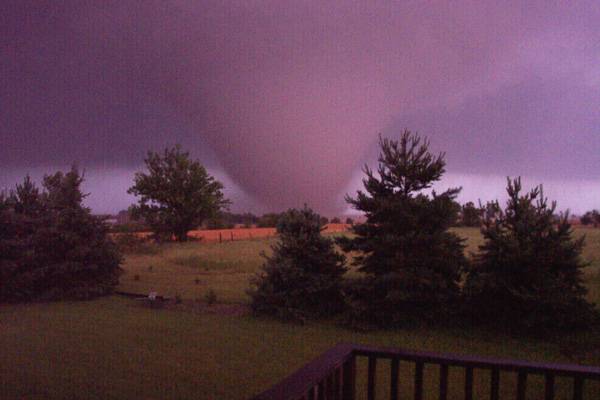
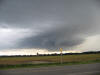
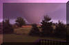
June 12th, 2004 Tornado
Storm spotting is another function of M.E.S. Living in Tornado Alley, this a frequent event during the spring and summer months.
National Weather Service Radar for Wichita, KS
Intellicast Radar for Wichita, KS
KSNW Radar for Wichita, KS
Watches versus Warnings
Many people confuse the meaning of a tornado "watch" and tornado "warning" issued by the National Weather Service. Here's the difference:
WATCH: Tornadoes are possible in your area; remain alert for approaching storms.
WARNING: A tornado has been sighted or indicated by weather radar. If a tornado warning is issued for your area and the sky becomes threatening, move to your pre- designated place of safety.
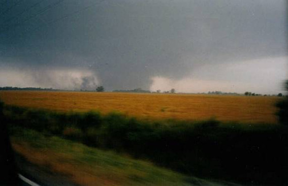
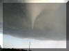
Tornado on the ground in Harper & Sumner Counties, May, 2004.
Safety and Preparedness
It is important to remain alert to signs of an approaching tornado and seek shelter if threatening conditions exist. Look for environmental clues including a dark sky, large hail or a loud roar.
If a warning is issued, move to a pre-designated shelter such as a basement; stay away from windows. If you do not have a basement or shelter, take refuge in an inner most area of the house and lay low.
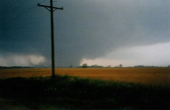
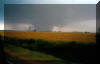
Tornado near Conway Springs, May, 2004.
Fujita Tornado Intensity Scale
A common misnomer regarding the Fujita scale is that many people confuse it to be a measurement of size of a tornado when in actuality it is the amount of destruction caused by the tornado.
Category F0: Gale tornado (40-72 mph); light damage. Some damage to chimneys; break branches off trees; push over shallow-rooted trees; damage to sign boards.
Category F1: Moderate tornado (73-112 mph); moderate damage. The lower limit is the beginning of hurricane wind speed; peel surface off roofs; mobile homes pushed off foundations or overturned; moving autos pushed off the roads.
Category F2: Significant tornado (113-157 mph); considerable damage. roofs torn off frame houses; mobile homes demolished; boxcars pushed over; large trees snapped or uprooted; light-object missiles generated.
Category F3: Severe tornado (158-206 mph); Severe damage. Roofs and some walls torn off well-constructed houses; trains overturned; most trees in forest uprooted; heavy cars lifted off ground and thrown.
Category F4: Devastating tornado (207-260 mph); Devastating damage. Well- constructed houses leveled; structure with weak foundation blown off some distance; cars thrown and large missiles generated.
Category F5: Incredible tornado (261-318 mph); Incredible damage. Strong frame houses lifted off foundations and carried considerable distance to disintegrate; automobile sized missiles fly through the air in excess of 100 yards; trees debarked; incredible phenomena will occur.
Tornado Events
for Mulvane
June 12, 1881 – An F2 Tornado moved NW of Mulvane to 3 miles NE of Douglas destroying two homes 1 mile north of Mulvane and injuring 2 people.
March 31, 1892 – Several tornadoes up to F4 moved NNE near South Haven and dissipating in extreme SE Sedgwick County resulted in 7 deaths and 40 injuries.
November 10, 1915 – An F4 tornado cut a 16 mile path from five miles SW of Zyba, passing within four miles south of Peck and dissipating near the edge of Derby. Eight homes were destroyed and three people were killed at Zyba. At least two homes were destroyed and one person was killed at Derby. In addition to four deaths, there were 28 injuries caused by the tornado.
June 20, 1942 – A strong tornado moved in a semi-circular path around the city of Mulvane.
May 25th, 1955 - 10:30 p.m. a tornado struck the Town of Udall, about 10 miles south of Mulvane.
November 27, 1960 – An F2 tornado touched down three miles NE of Mulvane and proceeded to within one mile south of Augusta causing destruction to barns and shifting one home. Two injuries were reported from an overturned car.
June 12th, 2004 - An F-3 tornado touched down one mile east and one mile south of Mulvane and proceeded to the Mulvane Sewer Plant before lifting and touching down within a 1/2 mile of the south city limits. Several homes and barns were destroyed, one horse was killed and some very minor injuries to motorists as it crossed K-15 highway. Damage was estimated at $575,000.
September 15, 2010 - A brief F-0 tornado touched
down over farm ground about 1250 N. Greenwich Road.
Weather Service Report.

 2015
2015